


(NEW YORK) — A severe weather threat continues over the Deep South on Saturday with tornadoes and flash flooding possible. A Flash Flood Watch remains in effect for more than 8 million Americans in parts of Alabama and Georgia until Saturday evening.
Early Saturday morning, there were already active storms over parts of the South, primarily in Mississippi. The main threat will be in the morning into the afternoon hours where conditions will be more favorable for severe development.
These storms will continue into the afternoon from New Orleans to Clemson, South Carolina — including cities like Atlanta and Pensacola. Damaging wind, tornadoes, and some large hail are the primary threats Saturday morning and into the day.
The threat will die down later in the afternoon and into the early evening but rain continues to push east and northeast from the late evening into the overnight hours.
Another few rounds of heavy rain are likely and could inundate areas of the South again, leading to a widespread additional 1 to 3 inches, with some localized areas of Mississippi, Alabama and Tennessee getting up to 3 to 4 inches of additional rain.
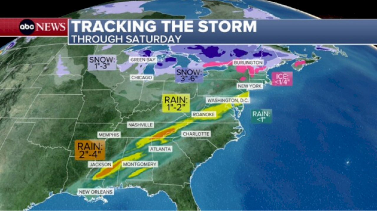
Rain is expected to fall in Philadelphia starting at 11 a.m., New York City after 12 p.m. and Boston and further up the I-95 corridor later in the afternoon. Rain will continue through much of the day across most of the Northeast down to the Mid-Atlantic.
On the northern side of the storm, some light snow — quick dusting up to 3 inches — could fall in Chicago on Saturday morning, but will be clear before the NFL Wild Card Matchup this evening.
Parts of Wisconsin and especially Michigan could see 3 to 6 inches of fresh snow on Saturday, while northern New England could be cold enough to see a dusting to 3 inches of snow and up to a tenth of an inch of ice.
Copyright © 2026, ABC Audio. All rights reserved.