Listeners:
Top listeners:
-
 play_arrow
94.3 Rev-FM The Rock of Texas | Where Texas Rocks
-
 play_arrow
99.1 The Buck Texas Country's Number 1 Country
-
 play_arrow
103.7 MikeFM Your Texas Hill Country Mix Tape
-
play_arrow
KERV 1230 AM
-
 play_arrow
JAM Sports 1 JAM Broadcasting Sports 1
-
play_arrow
JAM Sports 2 JAM Broadcasting Sports 2


Flash-flood threat continues in the Southwest, but outlook is improving
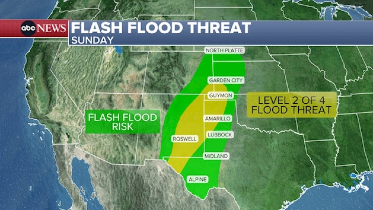
Parts of the Southwest could see more flash flooding Sunday after heavy rains caused flooding on Saturday in New Mexico and Colorado.
While the severe storm threat is less today, some storms Sunday afternoon and evening could be strong enough to produce gusty winds, isolated large hail and possible tornadoes.
A large area stretching from western Texas up into southwest Kansas is under a level 2 out of 4 threat Sunday for flooding.
Possible rainfall rates in parts of the Southwest could reach 2 inches per hour later Sunday.
Due to the ground being saturated from consecutive days of heavy rain across the region, the threshold for flash flooding is low for these areas, meaning it wouldn’t take much rain to cause rapid flash flooding.
The flood threat from Western Texas to southwest Kansas is expected to start winding down Monday, but some spotty flooding is still possible.
On Saturday, the San Juan River in New Mexico crested at 21 feet, the highest recorded crest since 1935, causing the river to overflow its banks and flood neighborhoods in Shiprock.
Onshore flow brings high-tide flooding to Southeast coast
In the Southeast, persistent onshore winds are expected to produce gusty winds and coastal flooding on Sunday.
An area of high pressure over the Northeast, combined with a non-tropical low-pressure system in the Atlantic, are creating a corridor of persistent winds blowing onshore over the Southeast coast.
Gusts of 20 to 35 mph are possible along the coast from Sunday to Tuesday.
The blustery conditions, combined with king tides in the area — the highest high tides of the year — have prompted coastal flood alerts through Tuesday from Miami to North Carolina’s Outer Banks.
Southeast Florida, from Port St. Lucie to Miami, is under a level 2 out of 4 flash-flood threat on Sunday.
Minor to moderate flooding is expected to occur during high tide, with major high-tide flooding possible for parts of the Florida and Georgia coasts.
Rough surf, rip currents and waves up to 12 feet are also possible in coastal waters from Florida to the Carolinas through Tuesday.
Copyright © 2026, ABC Audio. All rights reserved.


Top popular

Ingram man charged with murder after fatal shooting

Kerr Crime Stoppers offering reward up to $5,000 for information in last week’s non-viable school threat

KISD asks parents to communicate with children about words and actions after ‘copy cat’ threat note found at middle school

City of Kerrville Parks and Recreation reminds citizens that a Red Flag Warning is in effect until further notice

City of Kerrville says that May 7 General and Special Elections will proceed