Listeners:
Top listeners:
-
 play_arrow
94.3 Rev-FM The Rock of Texas | Where Texas Rocks
-
 play_arrow
99.1 The Buck Texas Country's Number 1 Country
-
 play_arrow
103.7 MikeFM Your Texas Hill Country Mix Tape
-
play_arrow
KERV 1230 AM
-
 play_arrow
JAM Sports 1 JAM Broadcasting Sports 1
-
play_arrow
JAM Sports 2 JAM Broadcasting Sports 2


California wildfires maps show evacuations, power outages, air quality
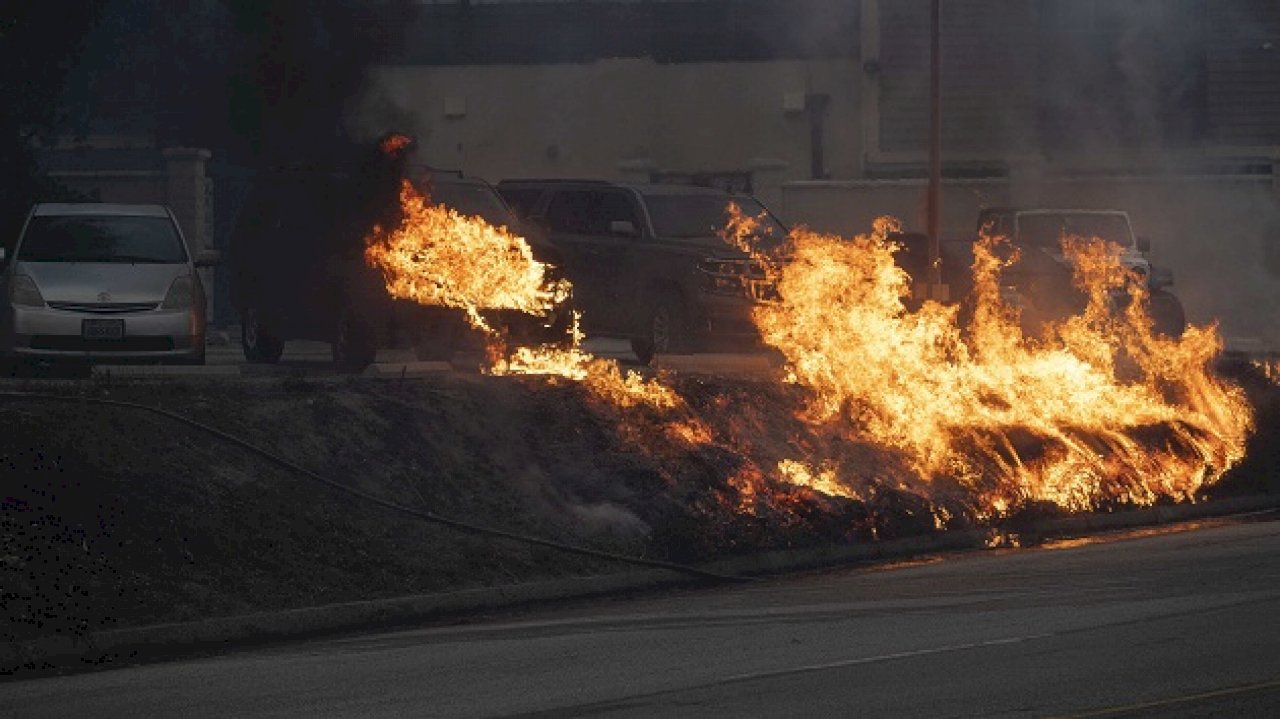
(LOS ANGELES) — Wildfires are tearing through thousands of acres in Los Angeles County in California, as strong Santa Ana winds stoke the blazes.
The Palisades Fire has impacted more than 2,920 acres, the Eaton Fire has impacted more than 2,200 acres, and the Hurst Fire has spread over more than 500 acres.
Each of the fires is 0% contained, according to the California Department of Forestry and Fire Protection, or CalFire.
Evacuation alerts
Evacuation orders from CalFire have been issued in the areas surrounding the Palisades, Eaton and Hurst fires.
Orders to evacuate in the Pacific Palisades, Topanga and eastern Malibu region reach to the Carbon Beach Terrace on the west side of the blaze. To the east and southeast, evacuation orders cover the Riviera, Rustic Canyon and Wilshire Montana regions, stretching to San Vincente Boulevard.
Orders to evacuate from the Eaton Fire are stretching through Altadena, La Cañada Flintridge, and large swaths of Pasadena and Glendale.
Orders to evacuate from the Hurst Fire are stretching through the suburban neighborhoods of Sylmar in Los Angeles, Whitney Canyon Park and Elsmere Canyon.
Residents can check for evacuation zones on CalFire’s interactive, updated map here: here.
Power outages
Roughly 319,493 customers are without power in California, according to poweroutage.us. Los Angeles County residents alone represent 226,245 of the customers facing outages.
About 27,184 customers in San Bernardino County; 24,840 in Riverside County; 14,965 in Orange County, 13,418 in Ventura County and 9,248 in San Diego County are affected.
Smoke and air quality
Across Southern California, residents are facing air quality conditions deemed hazardous by the U.S. Air Quality Index from the Environmental Protection Agency.
From Los Angeles to Pasadena, near the Eaton blaze, air sensors are picking up “hazardous” to “very unhealthy” conditions. Other surrounding areas — including near Redondo Beach, Torrance, and some parts of Los Angeles are also deemed “unhealthy.”
The EPA urges residents to wear N95 respirators to protect their lungs from smoke, limit time spent outdoors in the open air, and use an air purifier to reduce smoke particles indoors.
Check updated local air quality here.
Copyright © 2025, ABC Audio. All rights reserved.


Top popular

Ingram man charged with murder after fatal shooting

Kerr Crime Stoppers offering reward up to $5,000 for information in last week’s non-viable school threat

KISD asks parents to communicate with children about words and actions after ‘copy cat’ threat note found at middle school

City of Kerrville Parks and Recreation reminds citizens that a Red Flag Warning is in effect until further notice

City of Kerrville says that May 7 General and Special Elections will proceed