


(LOS ANGELES) — More than 41 million Americans across California, southern Nevada and northwest Arizona are under flood watches on Wednesday amid a rare, high risk for excessive rainfall and flooding.
This includes major metros like Los Angeles, San Francisco, Sacramento, California, San Diego and Las Vegas.
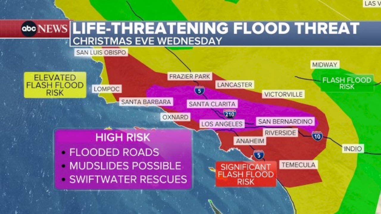
A “High Risk for excessive rainfall” is in place for Los Angeles, including I-10 from San Bernardino to Santa Monica and areas north like Highway 101 to Thousand Oaks, I-5 to Burbank, Santa Clarita, and up to Pyramid Lake and all of I-210. Travel on these roads is not recommended as they may become flooded, officials said. Low-lying neighborhoods in these areas could also become flooded, forecasts show.
Being under a “High Risk” designation is rare. This risk is only issued about 4% of days, accounting for one-third of all flood-related fatalities and 80% of all flood-related damages, according to the NWS.
Potential flooding impacts include the threat of significant and widespread urban roadway flooding, a high risk of major rock/mudslides, and rapid rises in creeks, streams and rivers which will likely lead to swift water rescues.
The recent burn scars will be at risk of possibly damaging debris flows. These flooding impacts will likely lead to significant travel delays and road closures during the busy holiday travel period.
Winds are forecast to gust 40 to 50 mph across the area, potentially leading to power outages on Wednesday, according to forecasts. Thunderstorms are also possible.
The heaviest rain is expected on Wednesday morning and afternoon. Rainfall rates of 1 inch per hour or greater are expected.
By 6 p.m. or 7 p.m. PT, the rain will be coming to a brief end before more rain arrives overnight.
Additional rounds of rain are expected on Thursday and Friday, and the flood threat along with mudslides and landslide risks will continue each day as well.
Copyright © 2025, ABC Audio. All rights reserved.