Listeners:
Top listeners:
-
 play_arrow
94.3 Rev-FM The Rock of Texas | Where Texas Rocks
-
 play_arrow
99.1 The Buck Texas Country's Number 1 Country
-
 play_arrow
103.7 MikeFM Your Texas Hill Country Mix Tape
-
 play_arrow
KERV 1230 AM
-
 play_arrow
JAM Sports 1 JAM Broadcasting Sports 1
-
 play_arrow
JAM Sports 2 JAM Broadcasting Sports 2
Friday weather: Ice storm warnings cover Midwest, as arctic blast slams East Coast

(NEW YORK) — The eastern half of the United States is enduring the latest arctic blast from Minnesota down to northern Florida and up to New England.
Lake-effect snow brought 3.5 feet of snow to western NY and up to 20 inches to northern Lower Michigan. Winds gusted to near 40 mph, creating whiteout conditions in heaviest lake-effect snow bands.
A Lake-Effect Snow Warning continued Friday morning for Ohio, Pennsylvania and western New York, where some areas could get additional 6 inches to 12 inches of snow.
The wind chills early Friday are below zero in Minneapolis, near zero in Chicago and in the teens and single digits above zero in the Northeast.
The temperature is near freezing in northern Florida and southern Georgia, where a Frost Advisory is posted.
Ice storm warning for Midwest
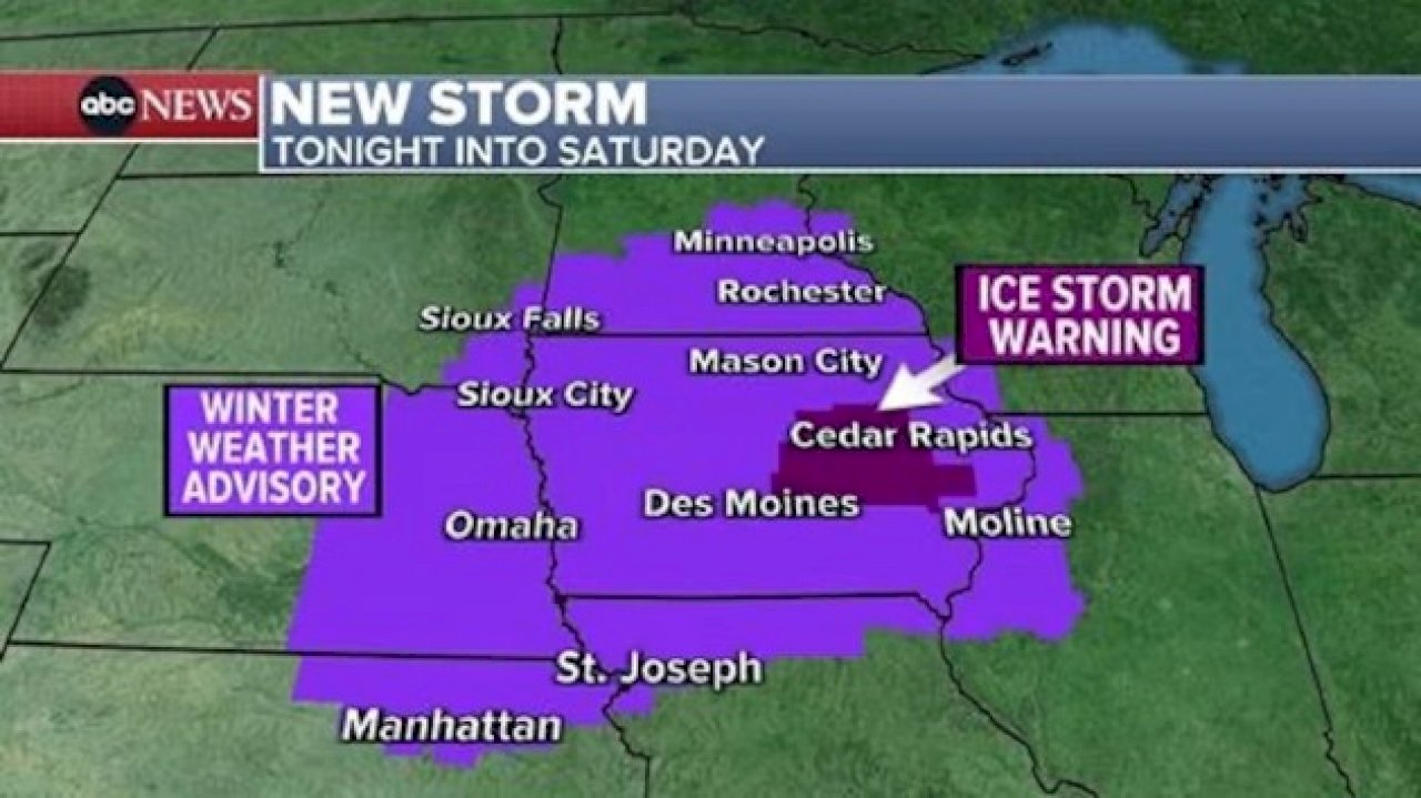
A new storm system is moving into the Plains and the Midwest on Friday evening into Saturday morning, with an Ice Storm Warning issued for Iowa and Icy Alerts issued from Kansas to Minnesota.
Freezing rain could glaze roads to more than a half an inch creating treacherous driving conditions.
Des Moines, Iowa, Minneapolis, Minnesota, and Omaha, Nebraska, are all under alerts later today and into Saturday morning. It will be raining with temperatures below freezing, and travel is strongly discouraged in the region through early Saturday.
West Coast flooding and heavy snow threat
A serious of storms will move into the West Coast through this weekend into next week, producing feet of snow in the mountains and several inches of rain along the coast.
Already, first storm brought up to half a foot of snow to I-80 in California’s Sierra Nevada mountains, creating a mess, with lots of accidents and major backups.
A new storm, even stronger, will move into the West Coast later today into Saturday from Washington to California, with heavy rain and mountain snow.
Locally 4 feet of snow is possible for California mountains, where Winter Storm Warning has been issued.
Heavy rain with up to 5 inches possible for northern California, where Flood Watch has been issued.
Areas north of the San Francisco Bay Area could see 2 inches to 3 inches of rain.
Copyright © 2024, ABC Audio. All rights reserved.
Written by: ABC News
-
Top popular

Ingram man charged with murder after fatal shooting

Kerr Crime Stoppers offering reward up to $5,000 for information in last week’s non-viable school threat

KISD asks parents to communicate with children about words and actions after ‘copy cat’ threat note found at middle school

City of Kerrville Parks and Recreation reminds citizens that a Red Flag Warning is in effect until further notice

City of Kerrville says that May 7 General and Special Elections will proceed


