


(NEW YORK) — Thunderstorms are in the forecast Saturday across parts of the central United States as a summer-like pattern continues to deliver hot temperatures and scattered severe weather.
The highest risk for severe weather on Saturday is along the New Mexico-Texas border, with damaging winds, large hail and a few tornadoes possible between Albuquerque and Amarillo. A Flood Watch has been issued for parts of New Mexico and the Texas panhandle.
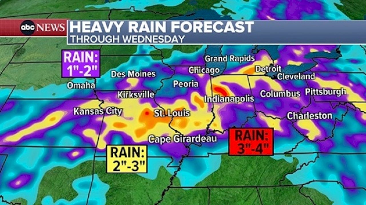
There is another area extending from Kansas to Wisconsin that may be producing strong to severe thunderstorms later, with damaging winds being the main threat. Flash flooding could be an issue as well, with 1″-3″ of rain across parts of the Midwest over the next 2 days.
Offshore storm affecting Northeast
A pesky storm system has parked itself off the coast of eastern Massachusetts, drenching Cape Cod and Nantucket with up to 4 inches of rain during the last few days.
Coastal Flood Alerts are in effect for several locations along the east coast, due to the combination of astronomical high tide and the rough surf from this offshore storm.
Minor coastal flooding of 1 to 2 feet is possible this weekend during high tide from the Mid-Atlantic into the Northeast. The storm will slowly pull away by early next week.
In the tropics
The chances for our next tropical system in the Gulf of Mexico are increasing, with a 60% likelihood for development as we head through next week.
The potential storm hasn’t even formed yet, but a storm is expected to take shape around the middle or end of next week, bringing a heavy rain threat to the Gulf Coast.
It is still far too early to determine potential impacts, but residents along the Gulf Coast should be monitoring this over the next several days.
Copyright © 2024, ABC Audio. All rights reserved.