


(NEW YORK) — A multiday severe weather outbreak is set to bring tornadoes, flash flooding and damaging winds from the Midwest to the South and the East Coast.
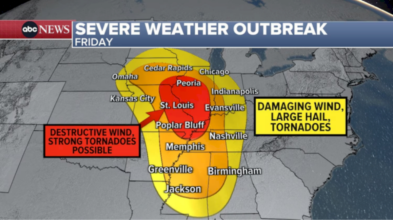
The severe weather begins in the Midwest on Friday night. Residents from Peoria, Illinois, to St. Louis, Missouri, to Paducah, Kentucky are in the bull’s-eye for damaging winds and potential tornadoes. This region is labeled level 4 out 5 for severe weather.
On Saturday afternoon and evening, the highest threat for tornadoes moves to the Deep South, focusing on Mississippi and Alabama.
A level 4 out 5 severe risk is in effect for New Orleans; Jackson, Mississippi; Mobile, Alabama; and Birmingham, Alabama, where strong/significant tornadoes and destructive winds are expected.
A level 3 out of 5 severe risk has been issued from Nashville, Tennessee, to Atlanta to the Florida Panhandle.
Severe storms could even stretch as far north as the Ohio Valley on Saturday.
On Sunday, the severe storms will be weaker as they target the East Coast from Florida to Pennsylvania.
Damaging winds, large hail and brief tornadoes will be possible for the Southeast on Sunday afternoon, while heavy rain and damaging winds will hit the Northeast on Sunday night.
Copyright © 2025, ABC Audio. All rights reserved.